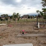
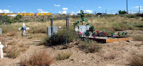
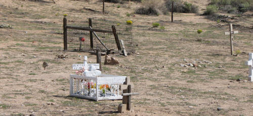
Canon del Carnuel Cemetery

Canon del Carnuel Cemetery, Bernalillo County, New Mexico
| Cemetery: | Canon del Carnuel Cemetery |
| GPS: | N 35.05716 W 106.46002 |
| County: | Bernalillo |
| Directions: | Exit 170 on I-40. Follow E frontage road (S side of I-40) 0.2 mi E of Silverhills turnoff to village of Santo Nino. Cemetery approx. 0.2 mi S from gate (sometimes locked). |
Canoncito Cemetery, Canoncito
Canoncito Cemetery, Canoncito, Bernalillo County, New Mexico
| Cemetery: | Canoncito Cemetery |
| GPS: | N 35.13518 W 106.37821 |
| County: | Bernalillo |
| Directions: | 3.4 mi N of I-40 at Tijeras on NM 14, W on Canoncito Road, W on Cole Springs Rd, lane on S side. |
Cedro Cemetery
| Cemetery: | Cedro Cemetery |
| AKA: | Cerro Cemetery |
| GPS: | N 35.02425 W 106.35496 |
| County: | Bernalillo |
| Directions: | From I-40, take Tijeras off ramp and go 9 miles south on NM 337. |
Evangelico Cemetery
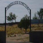
Evangelico Cemetery, Bernalillo County, New Mexico
| Cemetery: | Evangelico Cemetery |
| AKA: | Blake Street Cemetery (locally) |
| GPS: | N 35.03706 W 106.71621 |
| County: | Bernalillo |
| Directions: | 3900 block of Blake SW (0.2 mi W of Coors) (part of Armijo Land Grant) |
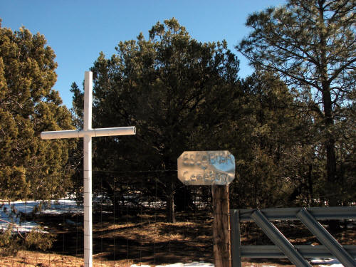
Escabosa Cemetery, Bernalillo County, New Mexico
Escabosa Cemetery, Bernalillo County, New Mexico
| Cemetery: | Escabosa Cemetery |
| AKA: | Yrissari Cemetery |
| GPS: | N 34.92552 W 106.28140 |
| County: | Bernalillo |
| Directions: | S from Tijeras NM on NM 337 to Escabosa; E on Jose Pohl Road; cemetery 0.5 mi at end of road. |
Fairview Memorial Park, Albuquerque
| Cemetery: | Fairview Cemetery |
| GPS: | N 35.07009 W 106.62190 |
| County: | Bernalillo |
| Directions: | Yale at Avenida Cesar Chavez SE. |
Gate of Heaven Cemetery
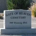
Gate of Heaven Cemetery
| Cemetery: | Gate of Heaven |
| GPS: | N 35.17241, W 106.56016 |
| County: | Bernalillo |
| Directions: | SW corner of Wyoming Blvd NE and Paseo del Norte NE. |
Juan Tomas Cemetery, Bernalillo County, New Mexico

Juan Tomas Cemetery, Bernalillo County, New Mexico
| Cemetery: | Juan Tomas Cemetery |
| GPS: | N 35.02797 W 106.30237 |
| County: | Bernalillo |
| Directions: | From I-40, take exit 181 and go E on NM333 to NM217, S 4.4 mi to Juan Tomas Rd, W approx. 3.25 mi to old church (N side), W 0.1 mi past Lower Juan Tomas Rd., S side gates, E gate. |
Los Padillas Cemetery, Albuquerque, Bernalillo County, New Mexico
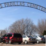
Los Padillas Cemetery, Albuquerque, Bernalillo County, New Mexico
| Cemetery: | Los Padillas Cemetery |
| GPS: | N 34.95633 W 106.71644 |
| County: | Bernalillo |
| Directions: | 5 mi S of Rio Bravo on Coors SW, 0.1 mi W on Los Padillas, S side. |
Mount Calvary Cemetery, Albuquerque

Mount Calvary Cemetery Sign
| Cemetery: | Mount Calvary Cemetery |
| AKA: | Santa Barbara Cemetery |
| GPS: | N 35.10287, W 106.63752 |
| County: | Bernalillo |
| Directions: | 1900 Edith Blvd NE. From I-25 and Menaul NE, W 0.5 mi to Edith, S just passed I-40 overpass, E side. |
Mountain Valley Cemetery
| Cemetery: | Mountain Valley Cemetery |
| AKA: | Barton Cemetery |
| GPS: | N 35.07654 W 106.24378 |
| County: | Bernalillo |
| Directions: | I-40 EXIT 181; Follow S side frontage road (NM 333) SE 2.7 mi to Barton Rd; S on Barton Rd 0.4 mi to cemetery, E side. |
Mountain View Cemetery, Albuquerque, Bernalillo County, New Mexico
| Cemetery: | Mountain View Cemetery |
| AKA: | Martinez Cemetery |
| GPS: | N 35.09224 W 106.62889 |
| County: | Bernalillo |
| Directions: | 0.25 mi W of University Dr NE, N side of Lomas (1100 Legion Rd NE) (NW corner of Legion and Lomas). |
Mt. Carmel Cemetery, Albuquerque, Bernalillo County, New Mexico

Mt. Carmel Cemetery, Albuquerque, Bernalillo County, New Mexico
| Cemetery: | Mt. Carmel Cemetery |
| GPS: | N 35.16838 W 106.61766 |
| County: | Bernalillo |
| Directions: | 1.2 mi N of Osuna Rd. NE on Edith Blvd. NE, E side. |
Pajarito Cemetery, Albuquerque, Bernalillo County, New Mexico
| Cemetery: | Pajarito Cemetery |
| GPS: | N 34.99133 W 106.71916 |
| County: | Bernalillo |
| Directions: | 3 mi S of Rio Bravo on Coors SW at the SW corner of Pajarito SW and Coors SW. |
Saint John's Cathedral Columbarium, Albuquerque, Bernalillo County, New Mexico
| Cemetery: | Saint John’s Cathedral Columbarium |
| GPS: | N 35.08229 W 106.65155 |
| County: | Bernalillo |
| Directions: | 318 Silver SW, Albuquerque (niches inside church). |
Saint John Nepomunceno Cemetery, Chilili
Saint John Nepomunceno Cemetery, Bernalillo County, New Mexico
| Cemetery: | Saint John Nepomunceno Cemetery |
| GPS: | N 34.88401 W 106.22312 |
| County: | Bernalillo |
| Directions: | 20 mi S Tijeras on NM 337 (0.7 mi SE of church in village of Chilili, E side of NM 337.) |
Saint Michaels and All Saint Church Columbarium, Albuquerque, Bernalillo County, New Mexico
| Cemetery: | Saint Michaels and All Saint Church Colubarium |
| GPS: | N 35.13917 W 106.64480 |
| County: | Bernalillo |
| Directions: | Saint Michaels and All Saints Church (Columbarium) is at 601 Montaño Rd, Albuquerque, NM. |
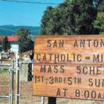
San Antonio de Padua Cemetery, Tijeras, Bernalillo County, New Mexico
San Antonio de Padua Cemetery, Tijeras, Bernalillo County, New Mexico
| Cemetery: | San Antonio de Padua Cemetery | |
| GPS: | Old Section: N 35.10367 W 106.37685 | New Section: N 35.10451 W 106.37552 |
| County: | Bernalillo | |
| Directions: | 2 mi N of Tijeras on NM 14 mi, W side. There is a new section approx. 0.25 mi further north. Two locations are marked for this cemetery. |
San Antonito Cemetery, San Antonito
San Antonito Cemetery, Bernalillo County, New Mexico
| Cemetery: | San Antonito Cemetery |
| GPS: | N 35.16374 W 106.34729 |
| County: | Bernalillo |
| Directions: | 6 mi N of Tijeras on NM 14 at the church, W side, just past Sandia Crest Rd. |
San Carlos Cemetery, Albuqurque
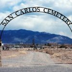
San Carlos Cemetery, Albuqurque, Bernalillo County, New Mexico
| Cemetery: | San Carlos Cemetery |
| Cemetery: | Alameda Cemetery |
| GPS: | N35.18429,W106.60379 |
| County: | Bernalillo |
| Directions: | Alameda Blvd, 1.2 mi W of I- 25. This cemetery is associated with the Nativity of the Blessed Virgin Mary Catholic Church which is about 1 mile west of the cemetery at the corner of Alameda Blvd (NM 528) and Fourth N.W. |
San Francisco Cemetery, Albuquerque
San Francisco Cemetery, Albuquerque, Bernalillo County, New Mexico
| Cemetery: | San Francisco Cemetery |
| AKA: | Candelaria Cemetery |
| GPS: | N 35.05225 W 106.64401 |
| County: | Bernalillo |
| Directions: | S of 610 Lace Rd SE, E of Arno SE, N of Woodward Road (?) down small alleyway. |
| Full Page Map: | ‘D’ = Alleyway entrance, ‘B’ = cemetery |
San Isidro Church Cemetery, Sedillo

San Isidro Church Cemetery, Sedillo, Bernalillo County, New Mexico
| Cemetery: | San Isidro Church Cemetery |
| AKA: | Sedillo Cemetery |
| GPS: | N 35.10018 W 106.29528 |
| County: | Bernalillo |
| Directions: | 6 mi E of Tijeras on I-40; exit 181, S Frontage Rd W to Via Sedillo, S to church; aka Sedillo, as well as aka San Isidro de Labrador Mission. |
San Jose Cemetery, Albuquerque
San Jose Cemetery, Albuquerque, Bernalillo County, New Mexico
| Cemetery: | San Jose Cemetery |
| AKA: | Benino Cemetery |
| AKA: | El Rosario Cemetery |
| GPS: | N 35.05913 W 106.64229 |
| County: | Bernalillo |
| Directions: | I-25 Exit at Gibson, cemetery on SW and NE corner (both sides of I-25). |
San Jose Armijo Cemetery, Albuquerque
San Jose Armijo Cemetery, Albuquerque, Bernalillo County, New Mexico
| Cemetery: | San Jose De Armijo Cemetery |
| AKA: | Arenal Cemetery |
| GPS: | N 35.05348 W 106.71164 |
| County: | Bernalillo |
| Directions: | West of Coors Blvd at Arenal SW, N on Don Santos St SW. (part of Armijo Land Grant). 2957 Arenal Rd SW. |
Sanchez Cemetery, Albuquerque
Sanchez Cemetery, Bernalillo County, New Mexico
| Cemetery: | Sanchez Cemetery |
| AKA: | Romero Cemetery |
| GPS: | N 35.13293 W 106.62699 |
| County: | Bernalillo |
| Directions: | 1/4 mi south of Edith and Montano NE, 1 block east (industrial park area). |
Sandia Memorial Gardens, Albuquerque
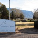
Sandia Memorial Gardens, Albuquerque, Bernalillo County, New Mexico
| Cemetery: | Sandia Memorial Gardens |
| GPS: | N 35.18811, W 106.57743 |
| County: | Bernalillo |
| Directions: | 9500 San Pedro NE. E side of I-25 at Alameda, 1 blk E, 2 blk north. |
Santa Clara Cemetery, Albuquerque

Santa Clara Cemetery, Bernalillo County, New Mexico
| Cemetery: | Santa Clara Cemetery |
| AKA: | Atrisco Cemetery |
| GPS: | N 35.07393 W 106.69241 |
| County: | Bernalillo |
| Directions: | 611 Foothill Dr SW, Albuquerque, NM 87105 (part of Armijo Land Grant) |
Santa Maria de la Vid Cemetery, Albuquerque
| Cemetery: | Santa Maria de la Vid Cemetery |
| GPS: | N 34.98444 W 106.72584 |
| County: | Bernalillo |
| Directions: | Norbertine Catholic Community at 5825 Coors Blvd SW. From Coors Blvd SW and Pajarito Rd SW, S about 0.3 mi to road going W; W over the ditch; then S and SW to community. Cemetery is on the grounds of the community. |
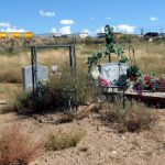
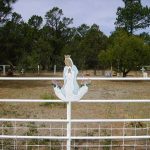
Santo Nino Cemetery, Carnuel
Santo Nino Cemetery, Carnuel, Bernalillo County, New Mexico
| Cemetery: | Santo Nino Cemetery |
| AKA: | Carnuel Cemetery |
| AKA: | Holy Child Cemetery |
| GPS: | N 35.05914 W 106.46761 |
| County: | Bernalillo |
| Directions: | Driving Directions: At Carnuel, take Exit 170 off I-40, S frontage Rd E 0.4 mi to Silver Heels Rd, S and W 0.3 mi; setback on S side. |
St Mary’s Cemetery
St Mary’s Cemetery, Bernalillo County, New Mexico
| Cemetery: | St Mary’s Cemetery |
| GPS: | N 34.99739 W 106.30465 |
| County: | Bernalillo |
| Directions: | S approx 8.7 mi from Tijeras on NM 337; E on Oak Flat Rd to Oak Flat Picnic grounds; Continue 1.2 mi on Oak Flat Rd to Anaya Pl. SE and NE on Anaya Pl; When Anaya Pl turns SE again, take dirt road straight ahead and follow it N to cemetery. |
Sunset Memorial Park, Albuquerque
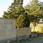
Sunset Memorial Park, Albuquerque, Bernalillo County, New Mexico
| Cemetery: | Sunset Memorial Park |
| GPS: | N 35.10912, W 106.63289 |
| County: | Bernalillo |
| Directions: | From the Southbound Pan American Frontage Rd and Menaul Blvd. NE intersection, W 0.25 mi to signal light, S on Lombardy Dr. |
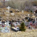
Tijeras Cemetery, Tijeras
Tijeras Cemetery, Tijeras, Bernalillo County, New Mexico
| Cemetery: | Tijeras Cemetery |
| GPS: | N 35.07590 W 106.38952 |
| County: | Bernalillo |
| Directions: | South at I-40 Exit 175 at Tijeras; S 0.25 mi on NM 337; turn right at Roosevelt Mid-School entrance; immediate S and W on dirt road to cemetery. |
Tohajiilee Cemetery, Tohajiilee Indian Reservation
| Cemetery: | Tohajiilee Cemetery |
| AKA: | Canoncito Navajo Indian Reservation Cemetery |
| AKA: | Platero Cemetery |
| GPS: | N 35.14549, W 107.086214 |
| County: | Bernalillo |
| Directions: | Exit 131 on W I-40 (9 miles W of Rio Puerco [Rt. 66 Casino]), N on Trail 56 (Canoncito School Rd) approximately 6.2 miles and turn west toward some buildings and a water tank. Keep left. Register at the Chapter Office in the Desidero Center, N of court house, on W side. Then N from Chapter House on same paved road 1.7 mi, turn E after crossing bridge, and immediately N on Trail 76 for 3.2 mi. Keep right at first ‘large’ intersection. Just past Pentecostal Church, W side, road has gentle curve to the NW. Before the Y in the road there is a old overgrown trail leading N and E to cemetery. |
Isleta Pueblo Cemetery, Isleta Village Proper, Bernalillo County, New Mexico

The San Agustin de la Isleta Mission in 1925.
| Cemetery: | Isleta Pueblo Cemetery |
| Cemetery: | San Agustín de Isleta Cemetery |
| GPS: | N 34.90351 W 106.69743 |
| County: | Bernalillo |
| Directions: | 14 mi S of Albuquerque on NM 314, E on Tribal 54 which merges with Tribal 55, which becomes Tribal 56 as you cross Tribal 40. S on Tribal 56 to cemetery. |
Villa Mathias Community, Bernalillo County, New Mexico
| Cemetery: | Villa Mathias Community |
| AKA: | Good Shepherd Brothers Villa |
| GPS: | N 35.09554 W 106.66070 |
| County: | Bernalillo |
| Directions: | 901 Brother Mathias Place NW, at Granite (Between 12th and 14th) |
What’s New?
Good Shepherd Brothers Villa, Albuquerque, Bernalillo County, New Mexico
This cemetery is better known as Villa Mathias Community, and you will be redirected to that listing.
Villa Mathias Community, Bernalillo County, New Mexico (in Albuquerque, NM)
This is a list of 6 burials occurring at the Villa Mathias Community (aka Good Shepherd Brothers Villa) in Bernalillo County, New Mexico.

San Agustín de Isleta Cemetery, Isleta Village Proper, Bernalillo County, New Mexico
This cemetery is better known as Isleta Pueblo Cemetery, and you will be redirected to that listing.
Martinez Cemetery, Albuquerque, Bernalillo County, New Mexico
This cemetery is better known as Mountain View Cemetery, and you will be redirected to that listing.
Yrissari Cemetery, Bernalillo County, New Mexico
This cemetery is better known as Escabosa Cemetery, and you will be redirected to that listing.
Romero Cemetery, Albuquerque, Bernalillo County, New Mexico
This cemetery is better known as Sanchez Cemetery, and you will be redirected to that listing.
Candelaria Cemetery, Albuquerque, Bernalillo County, New Mexico
This cemetery is better known as San Francisco Cemetery, and you will be redirected to that listing.

Benino Cemetery, Albuquerque, Bernalillo County, New Mexico
This cemetery is better known as San Jose Cemetery, and you will be redirected to that listing.
El Rosario Cemetery, Albuquerque, Bernalillo County, New Mexico
This cemetery is better known as San Jose Cemetery, and you will be redirected to that listing.

Carnuel Cemetery, Carnuel, Bernalillo County, New Mexico
This cemetery is better known as Santo Nino Cemetery, and you will be redirected to that listing.
Bernalillo County was established 8 January 1852. It was one of the seven Partidos, established during Mexican rule. It may have been named for the Gonzales-Bernal family that lived in the area before 1692. The county seat is Albuquerque. Bernalillo County has a high volume of commerce, farming, business, and real estate sales. Albuquerque has been thriving since 1706 and is the center of activity for fairs and conventions.
Number of Cemeteries
Number of Burials
Alphabetical List of Cemeteries in Bernalillo County
- Alameda Cemetery, Albuqurque, Bernalillo County, New Mexico
- Arenal Cemetery, Albuquerque, Bernalillo County, New Mexico
- Atrisco Cemetery, Albuquerque, Bernalillo County, New Mexico
- Barton Cemetery, Bernalillo County, New Mexico
- Benino Cemetery, Albuquerque, Bernalillo County, New Mexico
- Blake Street Cemetery (locally), Albuquerque, Bernalillo County, New Mexico
- Candelaria Cemetery, Albuquerque, Bernalillo County, New Mexico
- Canon del Carnuel Cemetery, Carnuel, Bernalillo County, New Mexico
- Canoncito Cemetery, Canoncito, Bernalillo County, New Mexico
- Canoncito Navajo Indian Reservation Cemetery, Tohajiilee Indian Reservation
- Carnuel Cemetery, Carnuel, Bernalillo County, New Mexico
- Cedro Cemetery, Bernalillo County, New Mexico
- Cerro Cemetery, Bernalillo County, New Mexico
- El Rosario Cemetery, Albuquerque, Bernalillo County, New Mexico
- Escabosa Cemetery, Bernalillo County, New Mexico
- Evangelico Cemetery, Albuquerque, Bernalillo County, New Mexico
- Fairview Memorial Park, Albuquerque, Bernalillo County, New Mexico
- Gate of Heaven Cemetery, Albuquerque, Bernalillo County, New Mexico
- Good Shepherd Brothers Villa, Albuquerque, Bernalillo County, New Mexico
- Holy Child Cemetery, Carnuel, Bernalillo County, New Mexico
- Isleta Pueblo Cemetery, Isleta Village Proper, Bernalillo County, New Mexico
- Juan Tomas Cemetery, Juan Tomas, Bernalillo County, New Mexico
- Los Padillas Cemetery, Albuquerque, Bernalillo County, New Mexico
- Martinez Cemetery, Albuquerque, Bernalillo County, New Mexico
- Mount Calvary Cemetery, Albuquerque, Bernalillo County, New Mexico
- Mountain Valley Cemetery, Bernalillo County, New Mexico
- Mountain View Cemetery, Albuquerque, Bernalillo County, New Mexico
- Mt. Carmel Cemetery, Albuquerque, Bernalillo County, New Mexico
- Pajarito Cemetery, Albuquerque, Bernalillo County, New Mexico
- Platero Cemetery, Tohajiilee Indian Reservation
- Romero Cemetery, Albuquerque, Bernalillo County, New Mexico
- Saint John Nepomunceno Cemetery, Chilili, Bernalillo County, New Mexico
- Saint John’s Cathedral Columbarium, Albuquerque, Bernalillo County, New Mexico
- Saint Michaels and All Saint Church Columbarium, Albuquerque, Bernalillo County, New Mexico
- San Agustín de Isleta Cemetery, Isleta Village Proper, Bernalillo County, New Mexico
- San Antonio de Padua Cemetery, Tijeras, Bernalillo County, New Mexico
- San Antonito Cemetery, San Antonito, Bernalillo County, New Mexico
- San Carlos Cemetery, Albuqurque, Bernalillo County, New Mexico
- San Francisco Cemetery, Albuquerque, Bernalillo County, New Mexico
- San Isidro Church Cemetery, Sedillo, Bernalillo County, New Mexico
- San Jose Cemetery, Albuquerque, Bernalillo County, New Mexico
- San Jose de Armijo Cemetery, Albuquerque, Bernalillo County, New Mexico
- Sanchez Cemetery, Albuquerque, Bernalillo County, New Mexico
- Sandia Memory Gardens, Albuquerque, Bernalillo County, New Mexico
- Santa Barbara Cemetery, Albuquerque, Bernalillo County, New Mexico
- Santa Clara Cemetery, Albuquerque, Bernalillo County, New Mexico
- Santa Maria de la Vid Cemetery, Albuquerque, Bernalillo County, New Mexico
- Santo Nino Cemetery, Carnuel, Bernalillo County, New Mexico
- Sedillo Cemetery, Sedillo, Bernalillo County, New Mexico
- St Mary’s Cemetery, Bernalillo County, New Mexico
- Sunset Memorial Park, Albuquerque, Bernalillo County, New Mexico
- Tijeras Cemetery, Tijeras, Bernalillo County, New Mexico
- Tohajiilee Cemetery, Tohajiilee Indian Reservation
- Villa Mathias Community, Bernalillo County, New Mexico (in Albuquerque, NM)
- Yrissari Cemetery, Bernalillo County, New Mexico

Recent Comments