Animas Creek Able Cemetery
| Cemetery: | Animas Creek Able Cemetery |
| GPS: | N 32.97390 W 107.34790 |
| County: | Sierra |
| Directions: | Private cemetery with 3 graves. I-25 Exit 63, E 0.2 mi to NM 187. N 0.8 mi on NM 187 to Animas Creek Rd (County Road B050) going W. W 2.8 mi on Animas Creek Rd (CR B050) to CR B059 going N. Follow CR B059 N 0.4 mi to cemetery, due N of residence. |
Arrey Catholic Cemetery
| Cemetery: | Arrey Catholic Cemetery |
| AKA: | San Jose Church Cemetery |
| GPS: | N 32.84638 W 107.32058 |
| County: | Sierra |
| Directions: | I-25 Exit 59; S 3.5 mi on NM 187, set back on W side. |
Arrey Cemetery, Arrey
Arrey Cemetery, Arrey, Sierra County, New Mexico
| Cemetery: | Arrey Cemetery |
| GPS: | N 32.84806 W 107.31978 |
| County: | Sierra |
| Directions: | I-25 Exit 59; S 3.4 mi on NM 187, W side. |
Arrey Community Church Cemetery

Arrey Community Church Cemetery, Sierra County, New Mexico
| Cemetery: | Arrey Community Church Cemetery |
| GPS: | N 32.81341 W 107.31240 |
| County: | Sierra |
| Directions: | I-25 Exit 59; S and SE 6 mi on NM 187, SW side. |
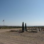
Caballo Cemetery, Caballo
Caballo Cemetery, Caballo, Sierra County, New Mexico
| Cemetery: | Caballo Cemetery |
| GPS: | N 32.92493 W 107.32007 |
| County: | Sierra |
| Directions: | I-25 Exit 63; E 0.2 mi to NM 187; 2 mi S on NM 187 to Snake Springs Rd (County Rd B046); W 0.2 mi to Cemetery, S side. |
Cuchillo Community Cemetery, Cuchillo
Cuchillo Community Cemetery, Cuchillo, Sierra County, New Mexico
| Cemetery: | Cuchillo Community Cemetery |
| GPS: | N 33.23318 W 107.35026 |
| County: | Sierra |
| Directions: | I-25 Exit 83; 7.5 mi N, W and S on NM 52 to Muskrat Road; S over cattle guard and keep right on Yuca Lane to cemetery. |
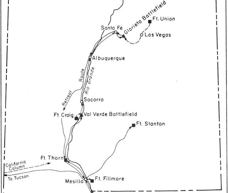
Fort McRae Cemetery

Map showing the location of McRae Fort and the Battle of Valverde, before both were inundated by lake Elephant Butte.
| Cemetery: | Fort McRae Cemetery |
| GPS: | N 33.19527 W 107.16473 |
| County: | Sierra |
| Directions: | You will need a boat and scuba gear to visit this abandoned cemetery beneath Elephant Butte Lake. |
Hillsboro Cemetery, Hillsboro

Hillsboro Cemetery, Sierra County, New Mexico
| Cemetery: | Hillsboro Cemetery |
| GPS: | N 32.91742 W 107.56518 |
| County: | Sierra |
| Directions: | From I-25 Exit 63, W on NM 152 to Hillsboro. S 0.3 mi on NM 27 to cemetery. |
Hot Springs Cemetery, Truth or Consequences
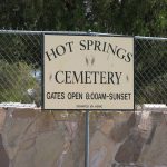
Hot Springs Cemetery, Truth or Consequences, Sierra County, New Mexico
| Cemetery: | Hot Springs Cemetery |
| GPS: | N 33.13933 W 107.24918 |
| County: | Sierra |
| Directions: | I-25 exit 79, E and S on Date St (BUS 25) to East Ninth Street; E 1 block to cemetery. |
Lake Valley Cemetery

Lake Valley Cemetery, Sierra County, New Mexico
| Cemetery: | Lake Valley Cemetery |
| GPS: | N 32.71463 W 107.56687 |
| County: | Sierra |
| Directions: | From Hatch, NM, NW and W 18.5 mi on NM 26 to NM 27 (Nutt); N 12.5 mi on NM 27 to cemetery access road, W side. |
Monticello Cemetery, Monticello
| Cemetery: | Monticello Cemetery |
| GPS: | N 33.39037 W 107.45065 |
| County: | Sierra |
| Directions: | I-25 Exit 83; from the W side of interchange, about 4.8 mi N and W on NM 52 to NM 142; about 16.5 mi NW and W on NM 142 to St. Ignatius church, (N side); S 0.6 mi on County Road CO32 (across from church) to cemetery entrance lane, W side; W to cemetery. |
Mountain View Cemetery, Chloride
| Cemetery: | Mountain View Cemetery |
| GPS: | N 33.33724 W 107.68369 |
| County: | Sierra |
| Directions: | I-25 Exit 83, N on NM 181 past airport to NM 52, W on 52 to Winston; S on Republic Road and CR C005 (may have a 157 marker) to CR 007 going W; N and W on CR 007 and CR 006 (Wall Street) to Chloride; Cemetery is S of Wall Street and to the W. |
Seco Creek Cemetery, Caballo
| Cemetery: | Seco Creek Cemetery |
| GPS: | N 32.98497 W 107.30419 |
| County: | Sierra |
| Directions: | I-25 Exit 63; E to NM 187; N 2.5 mi on NN 187 to just past the Seco Creek. E side. Private cemetery on old homestead. 4 graves, only 1 marked. |
Tidd Family Cemetery, Las Palomas
| Cemetery: | Tidd Family Cemetery |
| GPS: | N 33.06251 W 107.30135 |
| County: | Sierra |
| Directions: | I-25 Exit 71; E 0.5 mi on County Road B068. Private cemetery on N side of road and S side of creek at or on the Patty Tidd Farm.. Exact location unknown. |
Veterans Memorial Park Columbarium, Truth or Consequences
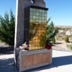
Veterans Memorial Park Columbarium, Truth or Consequences, Sierra County, New Mexico
| Cemetery: | Veterans Memorial Park Columbarium |
| GPS: | N 33.12060 W 107.26470 |
| County: | Sierra |
| Directions: | 996 S. Broadway. I-25 Exit 75; NE and E on Broadway (I- 25 Bus). S side, on the grounds of New Mexico State Veterans Home. |
Vista Memory Gardens, Truth or Consequences
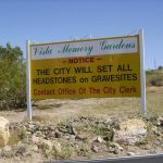
Vista Memory Gardens, Truth or Consequences, Sierra County, New Mexico
| Cemetery: | Vista Memory Gardens |
| GPS: | N 33.15758 W 107.26250 |
| County: | Sierra |
| Directions: | Exit 79 from I-25 at Truth or Consequences; W at top of off ramp onto Cemetery Road, just past large water tank, N side. |
What’s New?
Nunn Ranch, Sierra County, New Mexico
This is a list of 5 burials occurring at the Nunn Ranch in Sierra County, New Mexico.
Tierra Blanca Ranch Cemetery, Sierra County, New Mexico
This is a list of 5 burials occurring at the Tierra Blanca Ranch Cemetery in Sierra County, New Mexico.
Dines Ranch Cemetery, Sierra County, New Mexico
This is a list of 5 burials occurring at the Dines Ranch Cemetery in Sierra County, New Mexico.
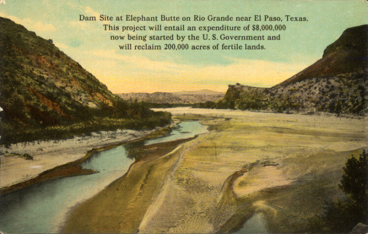
Los Alamosa Cemetery, Sierra County, New Mexico
This is information about Los Alamosa Cemetery in Sierra County, New Mexico. This cemetery is under water about a mile from shore, Elephant Butte Reservoir. There were some burials here before they built the dam. We cannot find whether they moved them (surely they did?) or it was just flooded. The dam was built in the 1916.
Fort McRae Cemetery, Sierra County, New Mexico
This is information about Fort McRae Cemetery in Sierra County, New Mexico.
Sierra County was formed 3 April 1884 out of portions of Socorro, Grant and Dona Ana Counties. Due to the location and population, Hillsboro became the first county seat. The Hillsboro Post Office was the hub for mail transportation to the surrounding offices in the southern part of the county. This county has many hills and mountains, especially attractive is the Sierra de los Caballos range. Hot Springs was the original county seat. It was changed in name to Truth or Consequences in 1950 after the famous TV show. It is commonly known today as T or C.
Alphabetical List of Cemeteries in Sierra County
- Animas Creek Able Cemetery, Sierra County, New Mexico
- Arrey Catholic Cemetery, Sierra County, New Mexico
- Arrey Cemetery, Arrey, Sierra County, New Mexico
- Arrey Community Church Cemetery, Sierra County, New Mexico
- Caballo Cemetery, Caballo, Sierra County, New Mexico
- Cuchillo Community Cemetery, Cuchillo, Sierra County, New Mexico
- Dines Ranch Cemetery, Sierra County, New Mexico
- Fort McRae Cemetery, Sierra County, New Mexico
- Hillsboro Cemetery, Hillsboro, Sierra County, New Mexico
- Hot Springs Cemetery, Truth or Consequences, Sierra County, New Mexico
- Lake Valley Cemetery, Sierra County, New Mexico
- Los Alamosa Cemetery, Sierra County, New Mexico
- Monticello Cemetery, Monticello, Sierra County, New Mexico
- Mountain View Cemetery, Chloride, Sierra County, New Mexico
- Nunn Ranch, Sierra County, New Mexico
- San Jose Church Cemetery, Sierra County, New Mexico
- Seco Creek Cemetery, Sierra County, New Mexico, N of Caballo
- Tidd Family Cemetery, Las Palomas, Sierra County, New Mexico
- Tierra Blanca Ranch Cemetery, Sierra County, New Mexico
- Veterans Memorial Park Columbarium, Truth or Consequences, Sierra County, New Mexico
- Vista Memory Gardens, Truth or Consequences, Sierra County, New Mexico
Old Cemetery List
Being caught in transition, unfortunately, temporarily brings with it 2 different methods of finding a grave. The list above are cemeteries which have been added to the new website, while the cemeteries in the list below are those that have not yet been transferred to this website. As we move the cemeteries over to the newer format, they will disappear below and appear above.
Note that the cemeteries in the list below are not searchable using the search for the website!
| Animas Graham |
| Apodaca |
| Armijo Family |
| Arrey |
| Arrey Community |
| Chiz |
| Chloride Mountain View |
| Cutter |
| Dines Ranch |
| Elephant Butte |
| Engle |
| Eugene Manlove |
| Hermosa |
| Kingston |
| Los Palomas |
| Nunn |
| San Miguel (SW of Cuchillo) |
| Santo Nino Chloride |

Recent Comments