Cedar Grove Cemetery

Cedar Grove Cemetery, Rio Arriba County, New Mexico
| Cemetery: | Cedar Grove Cemetery |
| GPS: | N 36.48699 W 106.49125 |
| County: | Rio Arriba |
| Directions: | S 0.4 mi from NM 115 on US 84 to road going E; E 0.2 mi on small dirt road to cemetery on S side. |
Cemeterio Catolico, Los Ojos
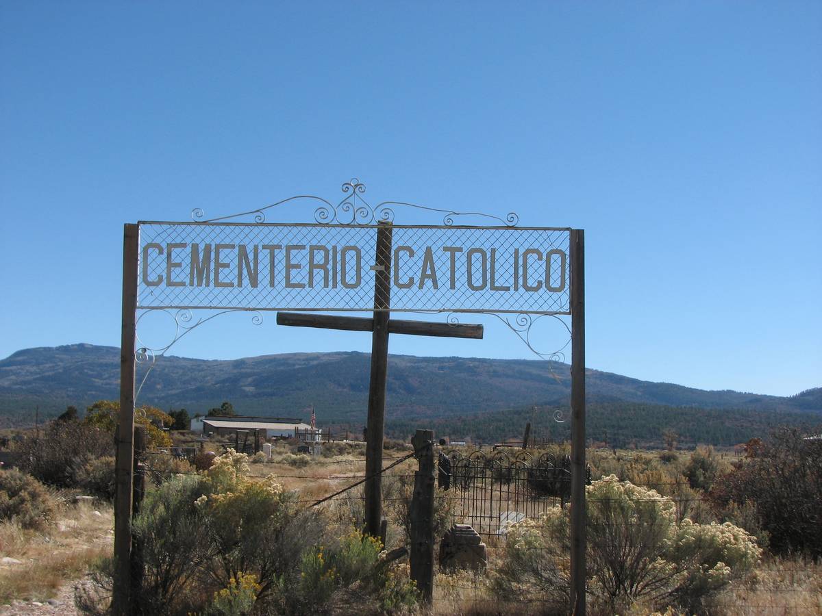
Cemeterio Catolico, Los Ojos, Rio Arriba County, New Mexico
| Cemetery: | Cemeterio Catolico |
| AKA: | Los Ojos Cemetery |
| GPS: | N 36.72633 W 106.56348 |
| County: | Rio Arriba |
| Directions: | From US 84 just S of Los Ojos, E and NE 0.2 mi on County Road 339A; Large cemetery is on E side. |
Chama Cemetery, Chama
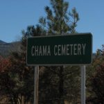
Chama Cemetery, Chama, Rio Arriba County, New Mexico
| Cemetery: | Chama Cemetery |
| GPS: | N 36.90151 W 106.57134 |
| County: | Rio Arriba |
| Directions: | From NM 17 north of Chama, just past river bridge, take road S at ‘Cemetery’ sign. Take left fork to cemetery; at end of road. |
Coyote Cemetery, Coyote, Rio Arriba County, New Mexico
| Cemetery: | Coyote Cemetery |
| GPS: | N 36.16478 W 106.61934 |
| County: | Rio Arriba |
| Directions: | From Youngsville (12 mi W of US 84/NM 96 junction), 4 mi W on NM 96 to Coyote and County Road (CR) 217 going S; S a short block on CR 217 to first left, that goes to cemetery. |
Dulce Community Cemetery, Dulce

Dulce Community Cemetery, Dulce
| Cemetery: | Dulce Community Cemetery |
| GPS: | N 36.94973 W 106.98743 |
| County: | Rio Arriba |
| Directions: | W about 2.5 mi from Lumberton on US 64 to County Road 537 going N; continue W 0.6 mi on US 64 to northbound Hawks Drive; N about 0.9 mi on Hawks Drive (might be called River Rd) to right turn on River Rd; follow River Rd N about 0.2 mi to cemetery road entrance of W side; cemetery on N side. |
El Rito Community Cemetery, El Rito
| Cemetery: | El Rito Community Cemetery |
| GPS: | N 36.35031 W 106.18278 |
| County: | Rio Arriba |
| Directions: | NW about 21 mi on US 84 from Espanola to NM 554 going NE; NE on NM 554 through El Rito to intersection of NM 554 and County Road (CR) 247 going straight ahead; follow dirt road adjacent to and SE of CR 247 to cemetery. |
Gallina Cemetery, Gallina
| Cemetery: | Gallina Cemetery |
| GPS: | N 36.22740 W 106.81852 |
| County: | Rio Arriba |
| Directions: | N from Cuba on US 550 to NM 96; N on NM 96, past Regina; continue N on NM 96, and E toward Gallina; E 0.3 mi from Coronado High School on N side to County Road (CR) 419; S on CR 419, and E to 2nd property on S side, the cemetery. |
Gallina Plaza Cemetery, Gallina
| Cemetery: | Gallina Plaza Cemetery |
| GPS: | N 36.23190 W 106.85667 |
| County: | Rio Arriba |
| Directions: | N from Cuba on US 550 to NM 96; N on NM 96, past Regina; continue N on NM 96, and E toward Gallina; after NM 96 turns E, E 5 mi to County Road (CR) 418; S 0.65 mi on CR 418 to cemetery, E side. |
Gavilan Cemetery, Gavilan
| Cemetery: | Gavilan Cemetery |
| GPS: | N 36.39197 W 107.03678 |
| County: | Rio Arriba |
| Directions: | N 6.7 mi from Lindrith on NM 595 to County Road 398 going NW; continue on NM 595 around curve to lane just E of structures on N ; N on lane to cemetery. |
La Madera Cemetery, La Madera
| Cemetery: | La Madera Cemetery |
| GPS: | N 36.39416 W 106.04765 |
| County: | Rio Arriba |
| Directions: | N 0.5 mi on NM 111 from NM 519 at La Madera to westbound County Road 259 (may be marked 258); W 0.25 mi to Y in road; keep right at Y and follow road 0.3 mi to cemetery. |
Lindrith Cemetery, Lindrith
| Cemetery: | Lindrith Cemetery |
| GPS: | N 36.29186 W 107.06991 |
| County: | Rio Arriba |
| Directions: | S of Lindrith on NM 595 to County Road (CR) 411; W on CR 411 to end of airstrip on your N side: N on first northbound road after airstrip; follow the curve to the W and to the cemetery, S side of road. |
Los Ojos (Old) Cemetery, Los Ojos

Los Ojos (Old) Cemetery, Los Ojos, Rio Arriba County, New Mexico
| Cemetery: | Los Ojos (Old) Cemetery |
| GPS: | N 36.72822 W 106.56302 |
| County: | Rio Arriba |
| Directions: | From US 84 just S of Los Ojos, E and NE 0.25 mi on County Road 339A to tiny dirt road N. N 0.1 mile to the old cemetery. |
Lovato Cemetery, N of Lumberton
| Cemetery: | Lovato Cemetery |
| GPS: | N 36.98079 W 106.89144 |
| County: | Rio Arriba |
| Directions: | N about 5.6 mi from Lumberton on County Road 357 to eastbound Cemetery Road; E 0.6 mi on Cemetery Road to cemetery, S side. |
Lumberton Cemetery, Lumberton
| Cemetery: | Lumberton Cemetery |
| GPS: | N 36.93290 W 106.93355 |
| County: | Rio Arriba |
| Directions: | On US 64 at Lumberton, NE 0.3 mi from County Road (CR) 357 to CR 355 going N; N about a block to cemetery. |
Lybrook Community Cemetery, Lybrook
| Cemetery: | Lybrook Community Cemetery |
| AKA: | Lybrook Mission Cemetery |
| GPS: | N 36.23425 W 107.57597 |
| County: | Rio Arriba |
| Directions: | NW from Cuba on US 550 to Counselor; continue about 7.3 mi on US 550 to Lybrook and northbound road just before the Escrito Trading Post on S side; N about 0.2 mi to westbound road; W 0.25 mi to cemetery. |
Nuestra Senora de Carmel Cemetery, Chimayo
Nuestra Senora de Carmel Cemetery, Chimayo, Rio Arriba County, New Mexico
| Cemetery: | Nuestra Senora de Carmel Cemetery |
| GPS: | N 36.01511 W 105.93782 |
| County: | Rio Arriba |
| Directions: | From just W of the Chimayo Post Office on NM 76, N on County Road (CR) 93 to CR 87; E and SE about 0.4 mi on CR 87 to cemetery entrance road on N side (tiny dirt lane). You can’t see the cemetery from CR 87. |
Ojito Cemetery
| Cemetery: | Ojito Cemetery |
| GPS: | N 36.39030 W 107.13747 |
| County: | Rio Arriba |
| Directions: | N 3 mi from Lindrith on NM 595 to County Road (CR) 402; W and N 7.8 mi on CR 402 to Ojito (at westbound CR 405); W 2 mi on CR 405 to CR 529; S and SW 2.6 mi on CR 529, keeping right at the Y along the way, to southbound road to cemetery; S 0.1 mi to cemetery, W side. |
Saint Francis Cemetery, Lumberton, Rio Arriba, New Mexico

Saint Francis Cemetery, Lumberton, Rio Arriba, New Mexico
| Cemetery: | Saint Francis Cemetery |
| GPS: | N 36.93290 W 106.93355 |
| County: | Rio Arriba |
| Directions: | On US 64 at Lumberton, N about a block on County Road 355; W side. |
San Antonio Cemetery, Alcalde
| Cemetery: | San Antonio Cemetery |
| GPS: | N 36.08565 W 106.05700 |
| County: | Rio Arriba |
| Directions: | N on US 285/NM 68 from Espanola, past Casino on E side, to just past San Juan Pueblo to westbound Day School St; W on Day School Street to County Road (CR) 40; N on CR 40 (White Swan Road) to westbound CR 104; continue a short distance on CR 40 to eastbound CR 106; Do a 3/4 U turn to your right immediately before CR 106 and follow dirt road to cemetery. |
San Jose de Chama Cemetery, Hernandez
| Cemetery: | San Jose de Chama Cemetery |
| GPS: | N 36.05682 W 106.12024 |
| County: | Rio Arriba |
| Directions: | 1.3 mi N of Road 1517/US 84 junction in San Jose on US 84/US 285 to El Camino de Abajo going E ( just N of Es Pererza going W); Continue short distance N to lane to church going W (sign on fence next to road says ‘San Jose de Chama Catholic Community); W to church and cemetery behind (W) of church. |
What’s New?
Women’s Club Cemetery, Espanola, Rio Arriba County, New Mexico
This is information about Women’s Club Cemetery in Espanola, Rio Arriba County, New Mexico.
Women’s Club Cemetery, Espanola, Rio Arriba, New Mexico
This is information about Women’s Club Cemetery in Espanola, Rio Arriba County, New Mexico.
Assembly of God Cemetery, Hernandez, Rio Arriba County, New Mexico
This cemetery is better known as Temple Zion Cemetery, and you will be redirected to that listing.
Temple Zion Cemetery, Hernandez, Rio Arriba County, New Mexico
This is a list of 2 burials occurring at the Temple Zion Cemetery in Hernandez, Rio Arriba County, New Mexico.
Schmidt Cemetery, Llaves, Rio Arriba County, New Mexico
This contains 1 burial record occurring at the Schmidt Cemetery in Llaves, Rio Arriba County, New Mexico.
Alphabetical List of Cemeteries in Rio Arriba County
- Assembly of God Cemetery, Hernandez, Rio Arriba County, New Mexico
- Cedar Grove Cemetery, Rio Arriba County, New Mexico (S of Cebolla)
- Cemeterio Catolico, Los Ojos, Rio Arriba County, New Mexico
- Cemeterio del Pueblo de Truchas, Rio Arriba County, New Mexico
- Chama Cemetery, Chama, Rio Arriba County, New Mexico
- Coyote Cemetery, Coyote, Rio Arriba County, New Mexico
- Dixon (Old) Catholic Cemetery, Rio Arriba County, New Mexico
- Dulce Community Cemetery, Dulce, Rio Arriba County, New Mexico
- El Rito Community Cemetery, El Rito, Rio Arriba County, New Mexico
- Gallina Cemetery, Gallina, Rio Arriba County, New Mexico
- Gallina Plaza Cemetery, Rio Arriba County, New Mexico (W of Gallina)
- Gavilan Cemetery, Gavilan, Rio Arriba County, New Mexico
- Inglesia de Santo Tomas Cemetery, Ojo Sarco, Rio Arriba County, New Mexico
- La Madera Cemetery, La Madera, Rio Arriba County, New Mexico
- Lindrith Cemetery, Lindrith, Rio Arriba County, New Mexico
- Los Ojos (Old) Cemetery, Los Ojos, Rio Arriba County, New Mexico
- Los Ojos Cemetery, Los Ojos, Rio Arriba County, New Mexico
- Lovato Cemetery, Rio Arriba County, New Mexico (N of Lumberton, NM)
- Lumberton Cemetery, Lumberton, Rio Arriba County, New Mexico
- Lybrook Community Cemetery, Lybrook, Rio Arriba County, New Mexico
- Lybrook LDS Cemetery, Lybrook, Rio Arriba County, New Mexico
- Lybrook Mission Cemetery, Lybrook, Rio Arriba County, New Mexico
- Martinez Cemetery, Ojo Sarco, Rio Arriba County, New Mexico
- Martinez Cemetery, Truchas, Rio Arriba County, New Mexico
- Nuestra Senora de Carmel Cemetery, Chimayo, Rio Arriba County, New Mexico
- Nuestra Senora de Dolores Cemetery, Rio Arriba County, New Mexico
- Ojito Cemetery, Rio Arriba County, New Mexico
- Sacred Heart Cemetery, Espanola, Rio Arriba County, New Mexico
- Saint Francis Cemetery, Lumberton, Rio Arriba County, New Mexico
- San Antonio Cemetery, Alcalde, Rio Arriba County, New Mexico
- San Antonio Churchyard Cemetery, Medanales, Rio Arriba County, New Mexico
- San Jose de Chama Cemetery, Hernandez, Rio Arriba County, New Mexico
- Schmidt Cemetery, Llaves, Rio Arriba County, New Mexico
- Temple Zion Cemetery, Hernandez, Rio Arriba County, New Mexico
- Trampas Cemetery, Rio Arriba County, New Mexico
- Truchas Pueblo Cemetery, Truchas, Rio Arriba County, New Mexico
- Women’s Club Cemetery, Espanola, Rio Arriba County, New Mexico
- Women’s Club Cemetery, Espanola, Rio Arriba, New Mexico
Old Cemetery List
Being caught in transition, unfortunately, temporarily brings with it 2 different methods of finding a grave. The list above are cemeteries which have been added to the new website, while the cemeteries in the list below are those that have not yet been transferred to this website. As we move the cemeteries over to the newer format, they will disappear below and appear above.
Note that the cemeteries in the list below are not searchable using the search for the website!
| Abiquiu Community |
| Alamosa Plaza Conchas |
| Apostolic Dixon |
| Burns Ranch |
| Camposanto Truchas |
| Canjilon |
| Capilla de San Jose (Hernandez) |
| Capilla de San Pedro (Chamita) |
| Catholic (Rio Chiquito) |
| Cebolla |
| Cemeterio Pueblo Truchas |
| Christ in the Desert |
| Cordova East |
| Cordova West |
| Dixon (new) Catholic |
| Dixon (old) Catholic |
| Dixon Community |
| El Sanctuario |
| Embudo Presbyterian |
| Ensenada |
| Father Kupper |
| Inglesia de las Virges |
| La Loma Vista |
| Las Tablas |
| Las Trampas |
| La Villita |
| Los Llanitos |
| Light House |
| Martinez Comm (Ojo Sarco) |
| Nuestra Senora Dolores (Chimayo) |
| Our Lady of Guadalupe (Velarde) |
| Rutheron |
| Rio Chiquito |
| Saint Annes (Alcalde) |
| Saint John The Baptist |
| San Miguel |
| San Rafael Del Guique |
| San Yglesia |
| Santa Clara Pueblo |
| Santo Nino |
| Santo Nino (Cebolla) |
| Truchas Presbyterian |
| Velarde |
| Youngsville |

Recent Comments